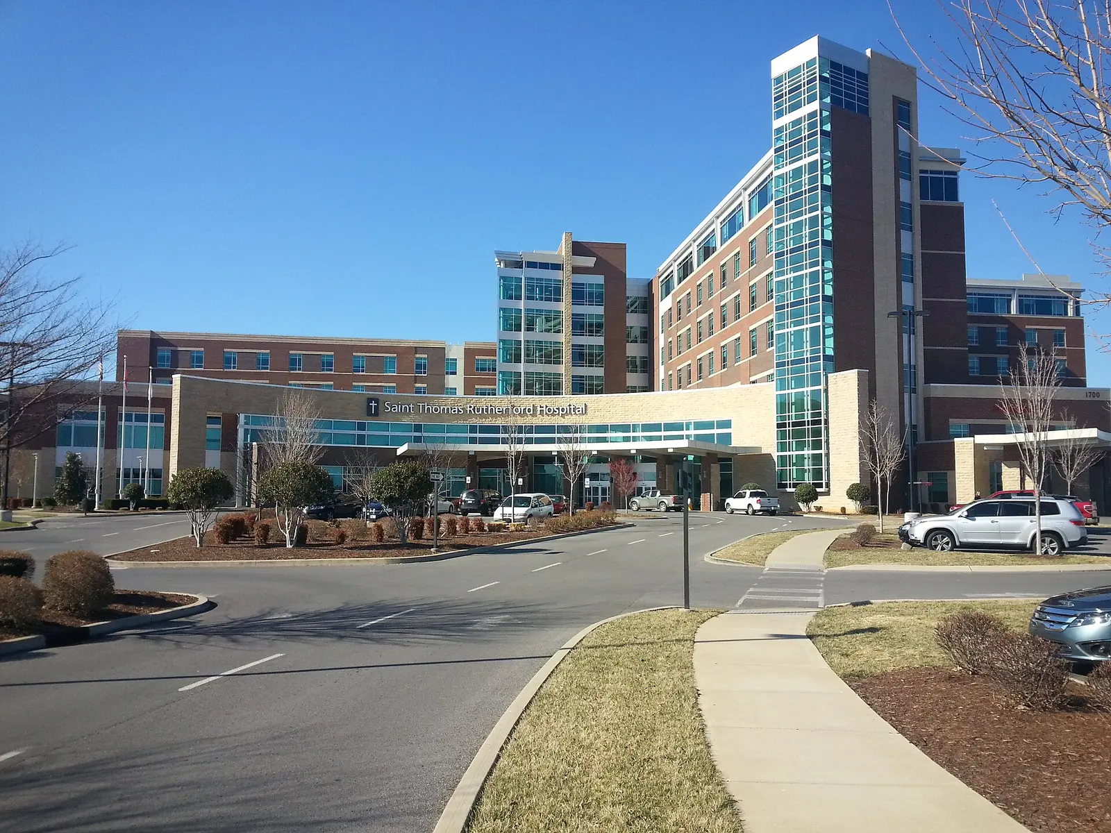
The Gateway along Medical Center Parkway in Murfreesboro, ZIP 37129: zoned for Blackman High, Gateway Island, The Avenue and a $442,156 typical home value.
Last checked Oct. 19, 2026. Sources: the City of Murfreesboro’s Murfreesboro 2035 plan, Chapter 4 (PDF) and parks pages, Rutherford County Schools’ 2026-27 zone map, the state’s 2024-25 letter grades, the Zillow Home Value Index, the Murfreesboro Transit ride guide (PDF) and OpenStreetMap.
The Gateway is the district that grew up along Medical Center Parkway, between I-24 and the older city to the east: hospitals and medical offices, The Avenue shopping center, apartments and homes, with Gateway Island and Old Fort Park along the Stones River.
What this means for you
- Zoned high school: mostly Blackman High, part Siegel High. Check the district zone map.
- Home value: $442,156 typical value in ZIP 37129 in September 2026, according to the Zillow Home Value Index.
- Nearest I-24 exits: exit 76 (Medical Center Parkway) and exit 78 (Old Fort Parkway).
Part of our Murfreesboro neighborhoods guide.
Where it is
The city’s Murfreesboro 2035 plan names The Gateway, with Stones River Mall, among the outlying commercial areas that overtook downtown as the city’s main shopping district, and lists a Gateway Design Overlay District among the city’s zoning districts. It describes The Avenue Murfreesboro, “an 810,000 square-foot open-air lifestyle retail center along Medical Center Parkway,” as “a compelling gateway-in to the City from Interstate 24.” The district runs along Medical Center Parkway from I-24 exit 76 toward Northwest Broad Street, with Old Fort Parkway (State Route 96) to the south. The Avenue is at 2615 Medical Center Parkway.
The area is in ZIP code 37129. Most of it is inside city limits, but the point we checked at The Avenue fell just outside the Census Bureau’s city boundary, so check whether an address is in the city. The city is widening Medical Center Parkway; dates are on our road construction page.
Schools
Zones split here at every level. Of 16 points we checked across the district on Rutherford County Schools’ 2026-27 zone map on Oct. 19, 10 were in the Murfreesboro City Schools zone for pre-K through sixth grade and six were in the zone of Rutherford County’s new Poplar Hill Elementary, 5100 Baker Road. City families can check their school with the MCS WebQuery lookup.
| Level | School | Points in zone | 2024-25 state grade |
|---|---|---|---|
| Middle | Poplar Hill Middle, 3695 Blackman Road | 14 of 16 | New school, not yet graded |
| Middle | Siegel Middle | 2 of 16 | A |
| High | Blackman High | 14 of 16 | B |
| High | Siegel High | 2 of 16 | A |
Poplar Hill Elementary and Middle opened for 2026-27, so the state has not graded them. More in our schools guide.
Home values
Zillow’s Home Value Index put the typical home in ZIP 37129 at $442,156 in September 2026, up 0.2% from $441,193 in September 2025, the only Murfreesboro ZIP code that rose over the year. The citywide figure was $424,348. The index is a modeled typical value for the middle third of homes, not a sale price. ZIP 37129 also covers the north side of the city. See our home prices page.
Parks and trails
- Gateway Island, 1875 W. College St.: a gazebo, waterfalls and a lake overlook, with a lit loop trail open 6 a.m. to 10 p.m. Park at the College Street Trailhead, 1902 W. College St.
- Old Fort Park, 1025 Old Fort Parkway: 50 acres with a skate park, pump track and the Kids’ Castle playground.
- The Stones River Trail of the greenway passes through, with the Manson Pike Trailhead and the Fortress Rosecrans Loop nearby.
- Stones River National Battlefield, 3501 Old Nashville Highway, is to the north.
More in our parks and trails guide.
Getting around
- I-24: exit 76 (Medical Center Parkway) and exit 78 (Old Fort Parkway), as mapped in OpenStreetMap.
- Distances on the road network: 2.6 miles to the Public Square and 26.4 miles to Nashville International Airport, measured from Medical Center Parkway near Gateway Island on the OpenStreetMap road network. These are distances, not drive times.
- Buses: the city’s July 2026 ride guide shows the Gateway route serving the Northfield Kroger, Saint Thomas Medical Center and The Oaks shopping center, and The Avenue route serving Stones River Mall, the AMC theater, The Avenue and Embassy Suites, with limited Saturday service. See our getting around guide.
Groceries and everyday stores
From OpenStreetMap:
- Walmart Supercenter, 2000 Old Fort Parkway
- Aldi, 640 Robert Rose Drive
- Trader Joe’s, near Medical Center Parkway
- Kroger, 1776 W. Northfield Blvd.
- Walgreens, 2006 Medical Center Parkway
- The Avenue Murfreesboro, 2615 Medical Center Parkway
How to check an address
Use the district zone map, the city schools WebQuery and our property taxes guide.
Frequently asked questions
Where is the Gateway in Murfreesboro?
The Gateway is the district along Medical Center Parkway between I-24 exit 76 and Northwest Broad Street, with Saint Thomas Rutherford hospital, The Avenue shopping center, Gateway Island and Old Fort Park around it.
What high school is the Gateway in Murfreesboro zoned for?
Mostly Blackman High. Of 16 points we checked on Rutherford County Schools’ 2026-27 zone map, 14 were zoned for Blackman High and two for Siegel High.
What ZIP code is the Gateway area in Murfreesboro?
ZIP code 37129. Zillow put the typical home value in 37129 at $442,156 in September 2026, up 0.2% from September 2025.
Does a bus serve Medical Center Parkway in Murfreesboro?
Yes. Murfreesboro Transit’s Gateway route serves Saint Thomas Medical Center and The Oaks shopping center, and The Avenue route serves The Avenue and Stones River Mall, weekdays 6 a.m. to 6 p.m.
Have your say